 When I read about the underwater excavation and survey of Pavlopetri, a Mycenaen village submerged off the southern tip of Greece, I wondered if the team might find some clues to the Greek Dark Ages in the remnants of this Mycenaen settlement.
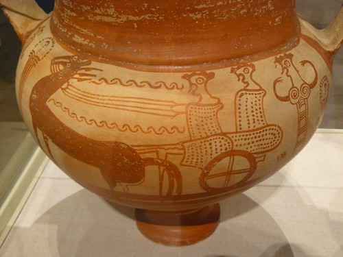
[Image: Terracotta chariot krater Helladic Mycenaean Late Helladic IIIB 1300-1230 BCE in the collection of the Metropolitan Museum of Art. Photo by Mary Harrsch]
The article says pottery dates abruptly stop at 1180 BCE which is significant as this marks the boundary period between the late Bronze Age and the period referred to as the Greek Dark Ages. Evidence that the city was not rebuilt would point to some kind of natural cataclysm of tremendous proportions. I immediately thought about the eruption of Thera but two studies reported in 2006 seem to support a much older date for that particular catastrophe:
"One study, led by archaeologist Sturt Manning at Cornell University, dated wood and seed samples collected from Akrotiri.Another study, led by geologist Walter Friedrich of the University of Aarhus in Denmark, uses a single branch to pinpoint the time of death for an olive tree believed to have been buried alive during the eruption.
Together, the two studies strongly suggest an eruption date of somewhere between 1660 and 1600 B.C. - More: Fox News
This later cataclysm, however, could have been part of an earthquake "storm" that rippled along the Mediterranean's eastern plate boundary in subsequent centuries.
The BBC seems to dismiss the possibility that earthquake storms could have been that devastating:
Most controversial is the theory that an earthquake storm may have been responsible for the abrupt physical and political collapse of Aegean Bronze Age world around 1200 BC. Some geologists and archaeologists point out that most of the ancient cities that fell at that time lie along the plate-boundary of the eastern Mediterranean and show signs of destruction typical of earthquakes. It supports a view that a storm of earthquakes successively ‘unzipped’ the plate boundary, so weakening the cities along the way that they were left vulnerable militarily, inviting attacks from opportunistic neighbours.
Earthquakes have frequently been used by historians and archaeologists as convenient explanations for cataclysmic destructions and abandonments. But earthquakes rarely wipe out entire cities, let alone entire regions. More often, seismic shocks leave cities as jumbles of ruined, damaged and intact buildings, encouraging their inhabitants not to flee but to stay and rebuild their houses and livelihoods. It is a pattern that we see in modern earthquake disasters, and there is little sign that human nature was any different in the past. - More: Journeys From The Centre of the Earth, BBC, Open2.net
However, this generalization does not seem to take into account the evidence from Pavlopetri that its people did not rebuild in the 12th century BCE or evidence from excavations at Sagalassos that their citizens abandoned their city after Arab raids and a catastophic quake in the 7th century CE (As coincidence would have it, I just viewed a film about the excavations at Sagalassos at the Archaeology Channel International Film Festival two days ago). On the contrary, these examples from the archaeological record seem to lend substance to the "earthquake and subsequent military vulnerability" theory as a reasonable causal hypothesis for such epochs of cultural decline.
The researchers are using a new sonar scanning technique that sounds like it will yield as detailed of images as a laser scanner.
"'We're using scanning sonar', which has been developed by an offshore engineering company [Kongsberg Mesotech in Vancouver, Canada, a subsidiary of Kongsberg Maritime, headquartered in Norway]. Their equipment does the same thing a terrestrial laser scanner would do, only using acoustic signals. It can take thousands of points over a couple of minutes and also take photorealistic impressions, so we could produce three-dimensional models using this equipment. Until now, sonar hasn't been able to produce as accurate a survey as terrestrial techniques. But if it does deliver everything it is supposed to, it could completely revolutionize underwater archaeology. Getting decent plans quickly is often a problem, and we often use measuring tapes and lines — which is effective, but time-consuming." - More: NatureNews
Nice article and theory. If their was a earthquake and war opportunists that devastated the city then wouldn't their be artifacts of war recovered? Also evidence points to the city being a trade hub would it not be more strategic for conquerors to occupy such a city. The most likely scenerio in my opinion is that the city is older then thought and the sea level was lower. As the sea level rose the peoples migrated from the region to nearby areas.
ReplyDelete